
Enhancing Campus Security: The Strategic Role of 2D Orthomosaic Mapping in Safeguarding Schools and Churches
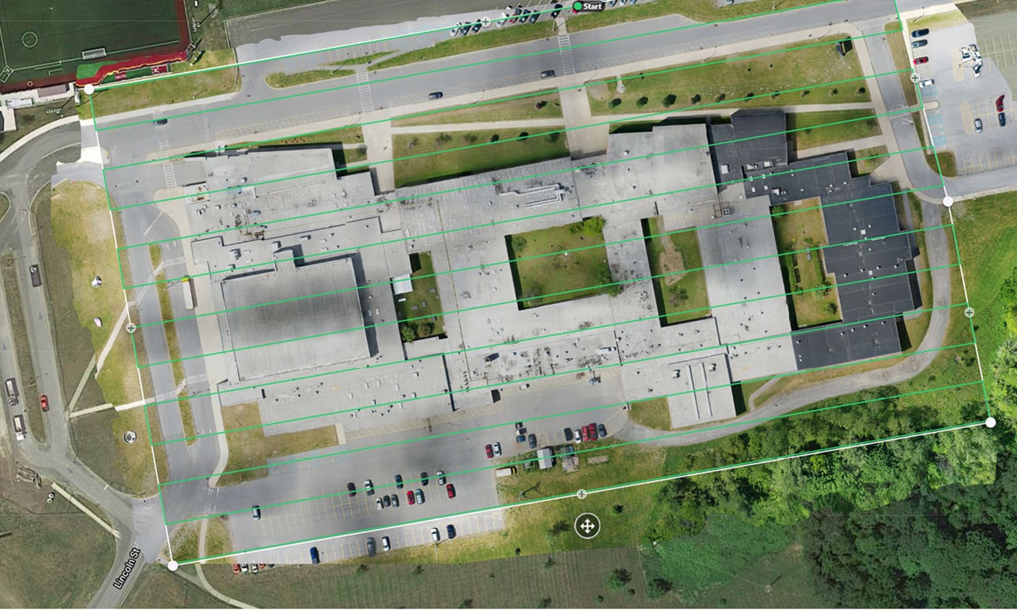
An orthomosaic map of a school campus.
2D orthomosaic maps are a sophisticated tool in the realm of aerial imaging, offering a seamless, highly detailed view of the earth's surface. Created by stitching together a series of overlapping aerial photographs taken from drones or aircraft, these maps maintain consistent scale and accuracy, presenting a true-to-life representation devoid of distortions typical in single photographic frames. The process meticulously aligns various elements from each photo, such as buildings, landscapes, and roads, to produce a coherent, comprehensive map.
The utility of 2D orthomosaic maps extends beyond mere visual representation; they serve as an invaluable resource for precision mapping and analysis. The level of detail captured allows for the identification of features and structures with exceptional clarity, making these maps an essential tool in various applications, from urban planning and land management to environmental monitoring. In the context of security, particularly for environments like school and church campuses, orthomosaic maps offer a bird's-eye view, facilitating detailed assessment and strategic planning to enhance safety and preparedness against potential threats.
2D orthomosaic mapping can be a valuable tool in enhancing the security of campuses in several ways:
Security Planning and Infrastructure Development: Orthomosaic maps provide accurate, high-resolution aerial views of campuses, allowing security planners to assess the current infrastructure, identify potential vulnerabilities, and plan security enhancements. These maps can help in designing new security features, such as fencing, lighting, and access control systems, ensuring they are optimally placed for maximum effectiveness.
Surveillance Optimization: By analyzing detailed 2D maps, security teams can determine the best locations for surveillance cameras and other monitoring equipment to ensure comprehensive coverage of key areas, including entry points, parking lots, and outdoor gathering spaces. This can help in minimizing blind spots and enhancing the overall surveillance capabilities.
Emergency Response and Evacuation Planning: Orthomosaic maps can be instrumental in developing and updating emergency response plans. They provide clear layouts that can be used to design evacuation routes, identify safe assembly points, and plan access routes for emergency services. These maps can be shared with local emergency responders to improve coordination during incidents.
Access Control and Traffic Flow Management: Detailed maps can assist in analyzing pedestrian and vehicle traffic flow, enabling administrators to implement measures that control access and movement around the campus. This can include optimizing the placement of barriers, gates, and signage to direct traffic effectively and reduce potential security risks.
Event Management: For events hosted on campus, orthomosaic maps can help in planning the layout of temporary structures, such as stages, seating, and vendor areas, while ensuring that emergency access and evacuation routes are maintained. This planning can enhance security by preventing overcrowding and ensuring that all attendees can be safely managed.
Vegetation and Landscape Management: These maps can reveal overgrown areas that might conceal threats or obstruct surveillance. Regular mapping can guide landscaping efforts to reduce hiding spots for unauthorized individuals and ensure clear lines of sight for surveillance equipment and personnel.
Maintenance and Facility Management: Orthomosaic mapping can aid in identifying maintenance issues that could impact security, such as damaged fences, lighting failures, or roof vulnerabilities. Timely detection and repair of such issues can prevent security breaches and ensure a safe environment.
Historical Documentation and Change Detection: Regular creation of orthomosaic maps allows institutions to maintain a historical record of their campuses. This can be useful for detecting changes over time, understanding how alterations to the physical environment may impact security, and documenting incidents for future reference and learning.
Incorporating orthomosaic mapping into the security strategy of church and school campuses requires careful planning and ongoing management to ensure the maps remain up-to-date and are effectively integrated into security protocols and emergency planning.